On 10 May 2025, the container ship MSC Antonia, a 304-metre, 7,000 TEU vessel, ran aground near the Eliza Shoals west of Jeddah, Saudi Arabia, while following a route it had used safely before. AIS tracking showed sudden, erratic jumps in position that could not be explained by mechanical issues. Maritime intelligence providers Windward, MarineTraffic, and Pole Star Global each confirmed what the ship’s crew could not have known at the time: the GPS system had received fake satellite signals, making the autopilot steer the vessel onto the shoals while the navigation team believed they were in safe waters (Inside GNSS, 2025). Less than two months later, two oil tankers, the Front Eagle and the Adalynn, collided in the Gulf of Oman. This happened in an area where Windward had recorded heavy satellite jamming and AIS spoofing in the days before the incident (Orca AI, 2025). The crews of both ships could not trust the navigation data their instruments showed. The MSC Antonia grounding and the Front Eagle collision are not isolated events. They are clear examples of what maritime intelligence analyst Michelle Wiese Bockmann of Windward calls a threat that is now “endemic” in waters near conflict zones and is spreading (CNN, 2026). This essay looks at the scale, methods, geopolitical causes, and real-world effects of GPS/GNSS spoofing and AIS manipulation in 2025 and 2026. It argues that what started as a tool for avoiding sanctions has become a widespread threat to the safety of maritime navigation.
The scale of GNSS interference has grown rapidly. Cydome’s 2026 Maritime Cyber Trends Report found about 1,000 GPS disruption incidents every day, affecting over 40,000 vessels (Industrial Cyber, 2026). Windward’s analysis for early 2025 showed AIS position jumps averaging 6,300 kilometers, a tenfold increase from the 600-kilometre average in late 2024. This points to more advanced and confusing spoofing operations (MarinePublic, 2025). GPSPATRON’s 2025 analysis showed a sharp rise in interference in the second quarter, with both regional and wider events reaching new highs. Nearly 3,000 vessels were disrupted in less than two weeks in the Persian Gulf and Strait of Hormuz during the June 2025 spike (GPSPATRON, 2025). In just the first quarter of 2025, more than 180 vessels in the Red Sea were affected by targeted spoofing, and the UK Maritime Trade Operations authority began issuing GNSS disruption advisories almost routinely (MarinePublic, 2025).
The war in Iran that started on 28 February 2026 made the crisis much worse. Within a day of the U.S.-Israeli strikes, Windward found 21 new areas where vessel AIS signals were jammed in the Strait of Hormuz and nearby waters (CNN, 2026). Bockmann called the situation for maritime navigation “extremely dangerous,” pointing out that ships had to reverse course or turn off AIS completely, even though it is the main tool for avoiding collisions, to avoid being noticed in contested waters. “When you have vessels thrown onto land or thousands of nautical miles across the sea,” she told CNN, “it is deeply, deeply troubling and dangerous” (CNN, 2026, para. 8–9).
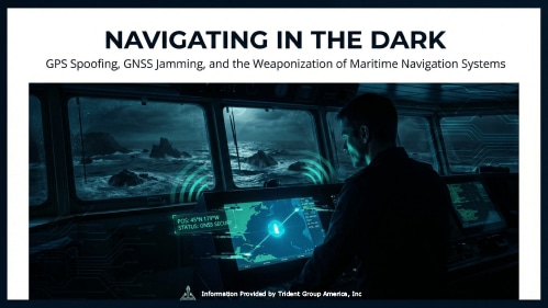
GNSS interference works in two main ways, each with different effects on detection and tracing the source. Jamming means sending out radio signals that overpower real GPS signals, making receivers lose their connection and show errors or gaps in position. This method does not need advanced equipment and can be used by both military and non-state groups. Spoofing is more complex and more dangerous because it sends fake satellite signals strong enough to replace the real ones, making the receiver show a completely false position (MarineTraffic, 2025). Nir Ayalon, CEO of maritime cybersecurity firm Cydome, explained to The Epoch Times: “Basically, their location was manipulated and the ship autopilot tried to fix the path to the path that it thought was the right one… so the ship grounded” (ZeroHedge, 2025, para. 7). Importantly, AIS, the automatic identification system used by all international vessels, has no cryptographic protection. As Ayalon said: “It does not require any encryption or any authentication, so you can basically add any information that you want there. It’s very easy to get into AIS data” (ZeroHedge, 2025, para. 9).
AIS spoofing, which is different from GNSS spoofing, means sending out false information about a vessel’s identity, position, or voyage. This can be done by the vessel itself or by someone else adding data to the AIS network. Kpler’s analysis showed that dark fleet tankers and ships avoiding sanctions often broadcast fake positions that show them in international waters, while they are actually loading sanctioned crude at restricted terminals. They create believable movement patterns at realistic speeds to avoid being detected by algorithms (Kpler, 2025). The June 2025 collision between the Front Eagle and the Adalynn showed how both threats can combine: the Front Eagle’s tracking data placed it onshore in Iran two days before the crash, which is a clear sign of GPS spoofing, while the Adalynn was operating without AIS and was identified by Lloyd’s List as a dark fleet vessel (Orca AI, 2025).
GNSS interference is not spread randomly; it closely follows areas of geopolitical conflict. By mid-2025, Latvian authorities had recorded over 820 jamming incidents linked to Russian activity. Jamming in the Baltic Sea has been steady and organized since 2022, especially around Russia’s Kaliningrad exclave and its western naval routes (GPSPATRON, 2025). In the Black Sea, spoofing has moved vessels hundreds of kilometers inland on Russian charts, matching military electronic warfare efforts to protect Russian energy shipping routes and undermine navigation confidence for commercial ships in contested waters (Research Square, 2026). In the Red Sea and Gulf of Aden, electronic interference increased through 2024 and 2025, directly linked to Houthi military actions and coalition responses. This pattern fits military GNSS denial operations rather than random criminal activity (Research Square, 2026).
A study published by Research Square in March 2026 found that GPS spoofing has “evolved from a theoretical vulnerability to an operational weapon within hybrid warfare strategies,” with incidents “indicating state-level involvement through proxy forces, particularly in regions of strategic importance, utilizing advanced electronic warfare capabilities that exceed typical non-state actor resources” (Research Square, 2026, para. 3). Russia’s Krasukha-4 and Tirada-2 electronic warfare systems, which were first made for military use, now seem to be used against civilian maritime infrastructure. This gives Russia a way to disrupt GNSS signals and hurt commercial shipping without starting a clearly identifiable armed attack (Research Square, 2026).
Regulations have not kept up with the fast-growing threat of GNSS interference. The Royal Institute of Navigation released a major report in early 2026 confirming what many maritime safety experts already believed: civilian GPS signals are “easy to overpower” because they become much weaker after traveling 20,000 kilometers from orbit. Dr. Ramsey Faragher, the report’s co-author, told CNN, “we’ve known for decades that the signals that civilians rely on from space are vulnerable to jamming and spoofing. It’s just that it’s never been this serious a problem before” (CNN, 2026, para. 12–13). The Galileo satellite navigation system added an authentication feature in 2025 so users can check if signals are genuine, but most commercial maritime receivers do not support this yet, and updating the global fleet will take years (CNN, 2026).
The U.S. Coast Guard’s 2025 cybersecurity rule requires ships to use resilience strategies like GNSS redundancy and cross-checking. These backup methods help navigators spot spoofing by comparing GPS data with radar, visual bearings, and inertial navigation (Pen Test Partners, 2025). The IACS UR E26 rule for new ships also covers “fail-safe” operation during cyber incidents, including navigation system problems (Speedcast, 2025). However, thousands of ships already at sea were built before these standards. In areas where 1,000 spoofing events happen daily, navigators now have to decide for themselves when to question the instruments they were trained to trust—a challenge that most training programs do not yet address well.
GPS spoofing and AIS manipulation are now central issues in maritime security. Incidents like a container ship running aground, a tanker collision, a dark fleet vessel sending false coordinates while loading sanctioned crude, and a 3,000-vessel disruption in a key energy chokepoint are all signs of the same problem: the maritime industry’s heavy reliance on navigation signals that are not authenticated and can be easily faked. State actors have shown they can and will manipulate these signals for their own advantage. Fixing this problem will take improvements in receiver authentication technology, better bridge crew training in using multiple sources to check positions, stronger regulations for GNSS redundancy, and, most importantly, a new understanding that what appears on a ship’s chart plotter can no longer be trusted as a true picture of reality.
CNN. (2026, March 6). Ships and planes are vulnerable to GPS jamming. The Iran war is revealing just how bad the problem is. https://www.cnn.com/2026/03/06/science/gps-jamming-ships-planes-iran-war
GPSPATRON. (2025, October 24). Maritime GNSS interference worldwide: A cumulative analysis 2025.https://gpspatron.com/maritime-gnss-interference-worldwide-a-cumulative-analysis-2025/
Industrial Cyber. (2026, March). Cydome report finds 150% surge in maritime OT cyberattacks as ransomware tightens grip in 2025.https://industrialcyber.co/transport/cydome-report-finds-150-surge-in-maritime-ot-cyberattacks-as-ransomware-tightens-grip-in-2025/
Inside GNSS. (2025, May 15). MSC Antonia grounding in the Red Sea attributed to suspected GNSS spoofing.https://insidegnss.com/msc-antonia-grounding-in-the-red-sea-attributed-to-suspected-gps-spoofing/
Kpler. (2025, November 10). AIS spoofing: The fast track to sanctions.https://www.kpler.com/blog/ais-spoofing-fast-track-to-sanctions
MarinePublic. (2025). Maritime GPS spoofing: MSC Antonia grounding and cyber threats.https://www.marinepublic.com/blogs/distress/952883-maritime-gps-spoofing-msc-antonia-grounding-cyber-threats
MarineTraffic. (2025). Understanding AIS and GNSS spoofing.https://support.marinetraffic.com/en/articles/11588240-understanding-ais-gnss-spoofing
Orca AI. (2025, December 17). When GPS and AIS go blind — how to navigate safely.https://www.orca-ai.io/blog/spoofed-jammed-blind-why-ships-now-need-digital-eyes/
Pen Test Partners. (2025, September 10). New mandatory USCG cyber regulations: What you need to know.https://www.pentestpartners.com/security-blog/new-mandatory-uscg-cyber-regulations-what-you-need-to-know/
Research Square. (2026, March). Emerging maritime threats in global geopolitics: GPS spoofing as a tool of hybrid warfare in strategic maritime chokepoints. https://www.researchsquare.com/article/rs-8901159/v1
Speedcast. (2025). Cybersecurity IACS E26 and E27. https://www.speedcast.com/blog-hub/2025/iacs-e26-e27-standards/
Windward AI. (2025, October 27). The real impact of GPS jamming on maritime operations.https://windward.ai/blog/gps-jamming-is-now-a-mainstream-maritime-threat/
ZeroHedge. (2025, September 29). Ships running blind: How GPS spoofing is on the rise.https://www.zerohedge.com/geopolitical/ships-running-blind-how-gps-spoofing-rise